
- Lori Ann Bugliaro P.A., PA,REALTOR ®
- Tropic Shores Realty
- Helping My Clients Make the Right Move!
- Mobile: 352.585.0041
- Fax: 888.519.7102
- Mobile: 352.585.0041
- loribugliaro.realtor@gmail.com

Active
Property Photos


- MLS#: G5087916 ( Land )
- Street Address: 12075 Virginia Drive
- Viewed: 45
- Price: $115,000
- Price sqft: $0
- Waterfront: Yes
- Wateraccess: Yes
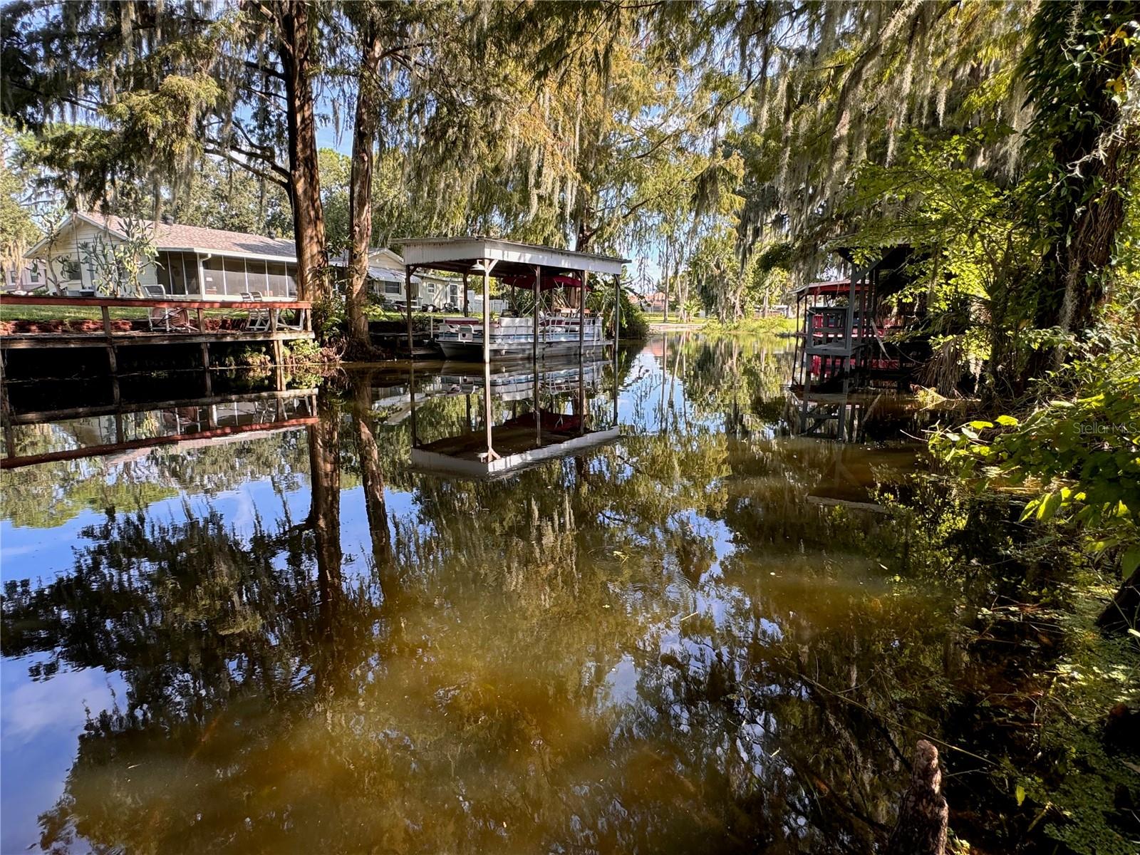
- Waterfront Type: Canal - Freshwater
- Year Built: Not Available
- Bldg sqft: 0
- Days On Market: 499
- Additional Information
- Geolocation: 28.8412 / -81.7558
- County: LAKE
- City: LEESBURG
- Zipcode: 34788
- Subdivision: Western Shores
- Provided by: NARROW ROAD REALTY
- Contact: Brad Verkaik
- 352-589-8100

- DMCA Notice
-
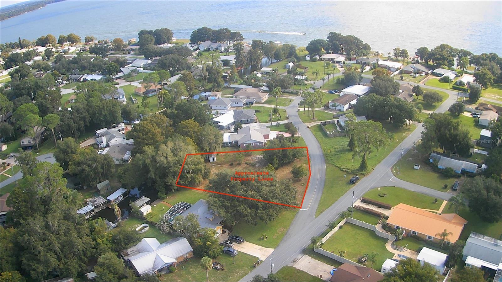
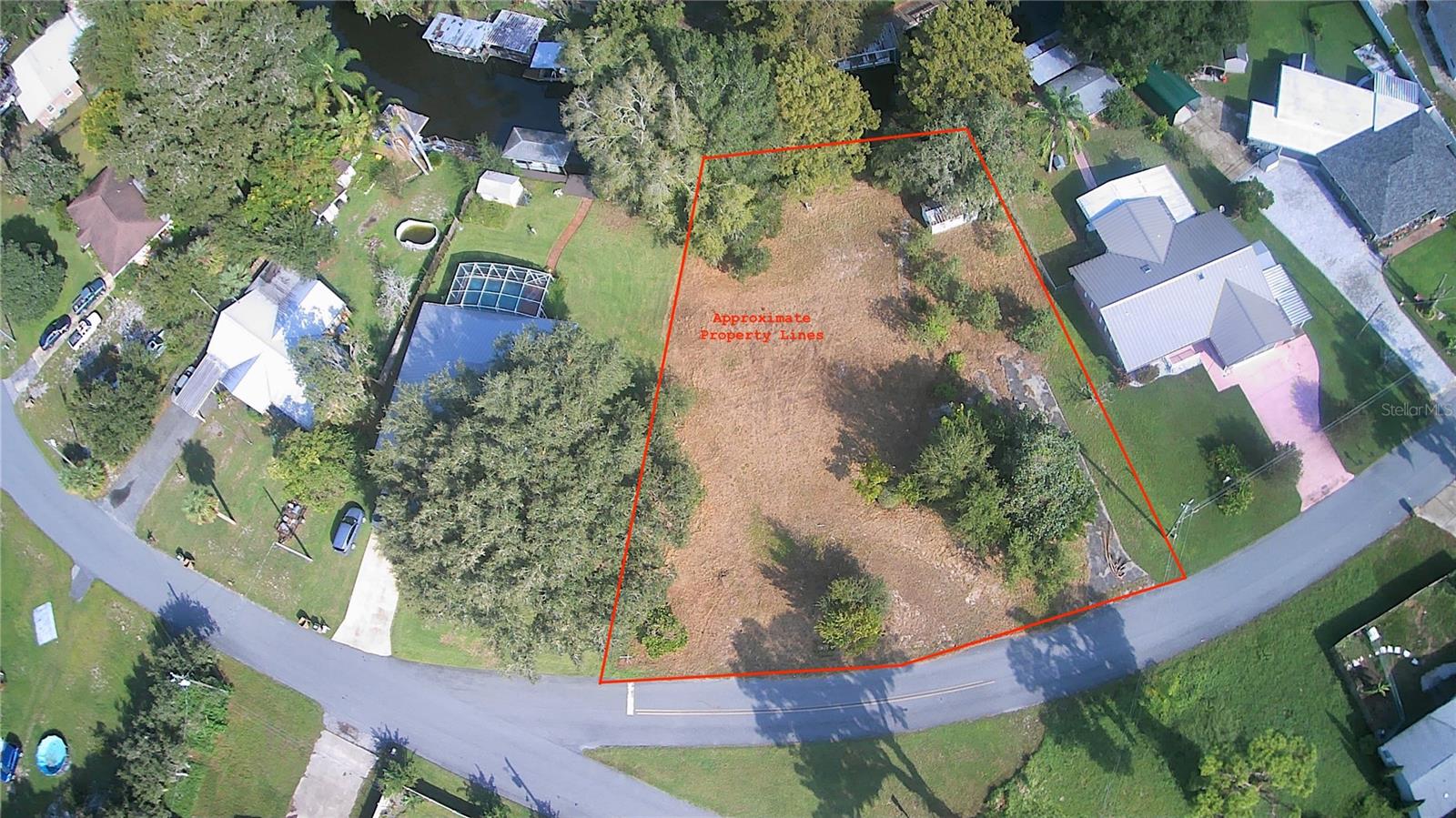
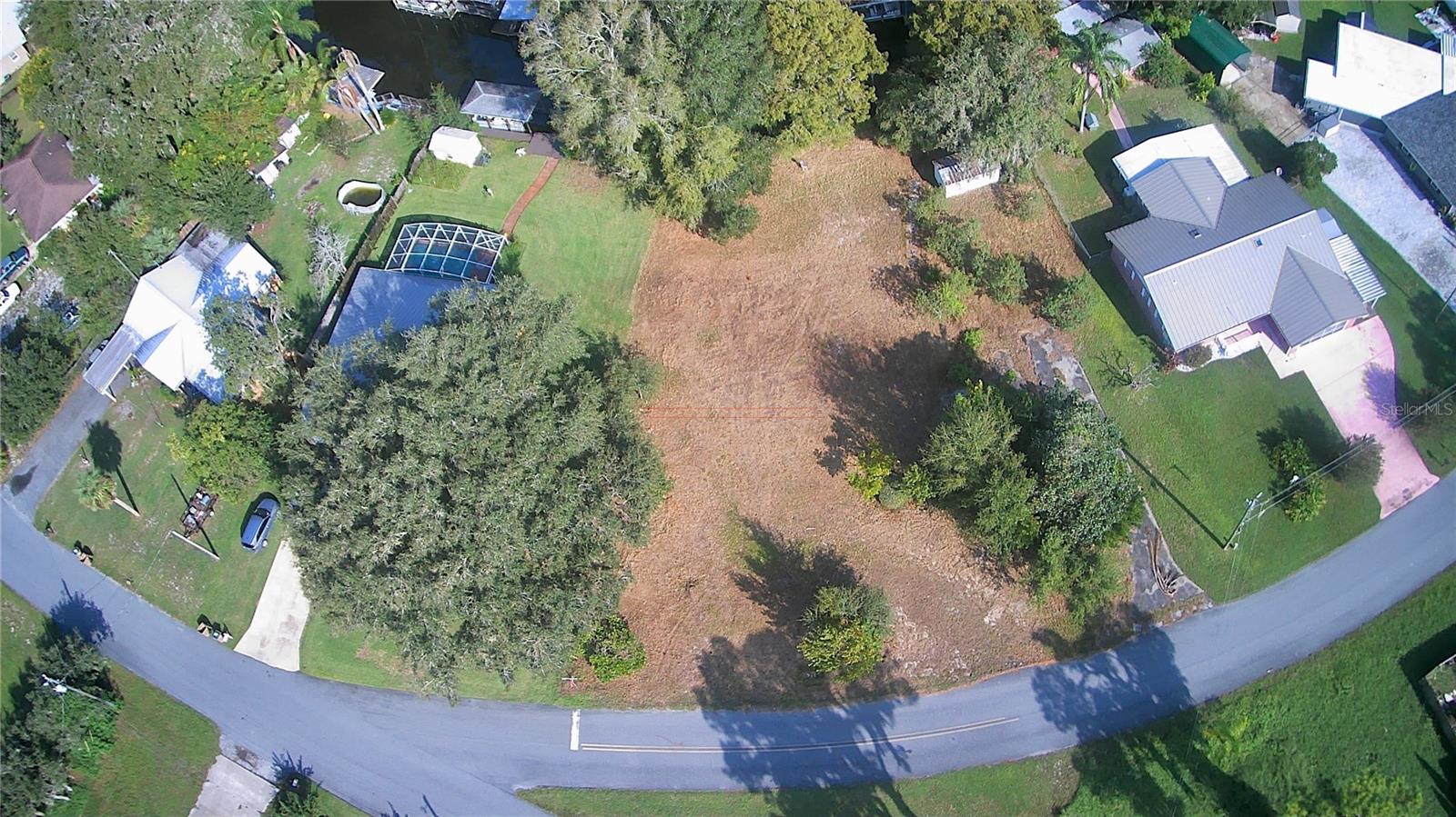
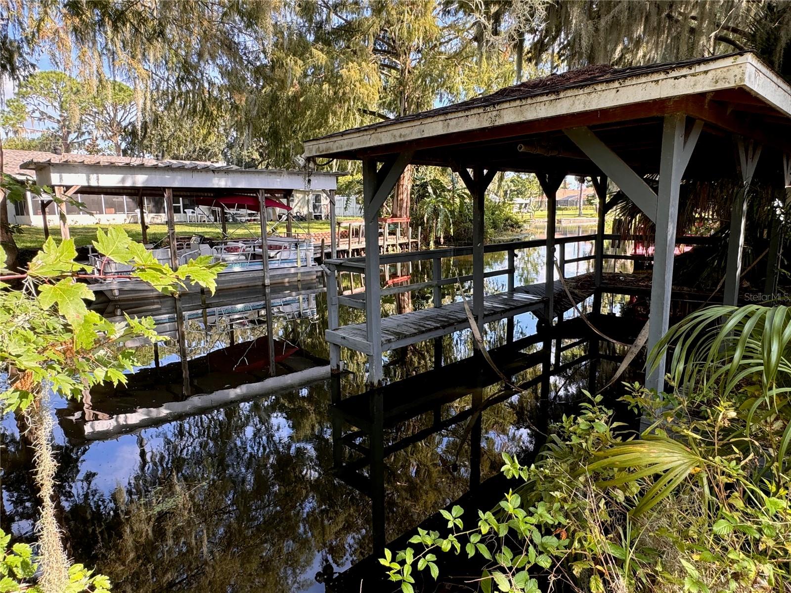
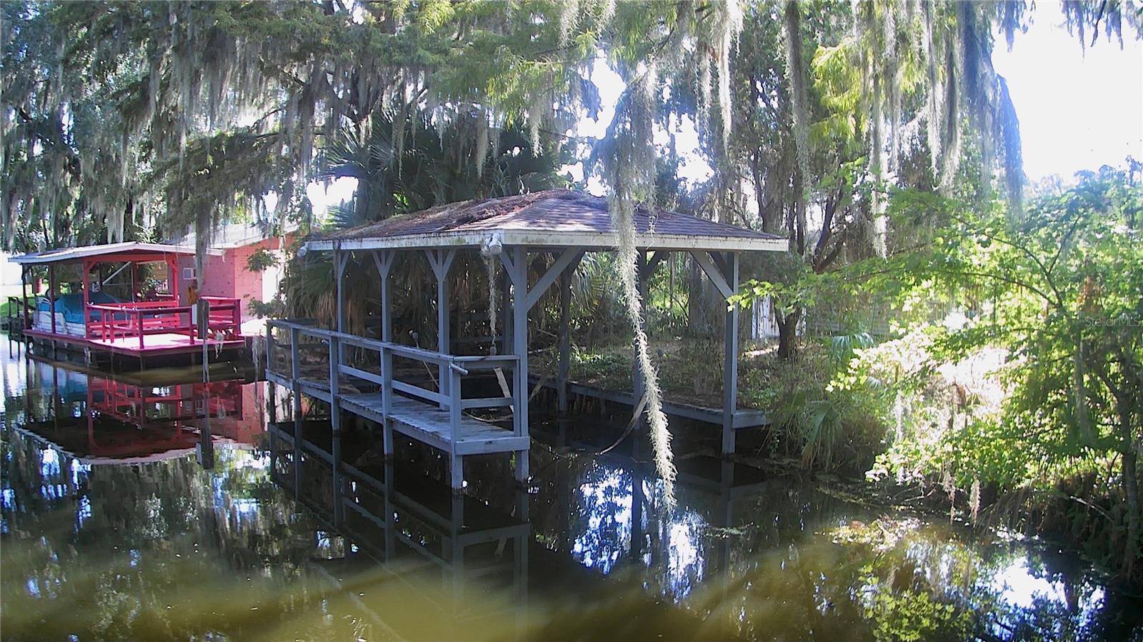
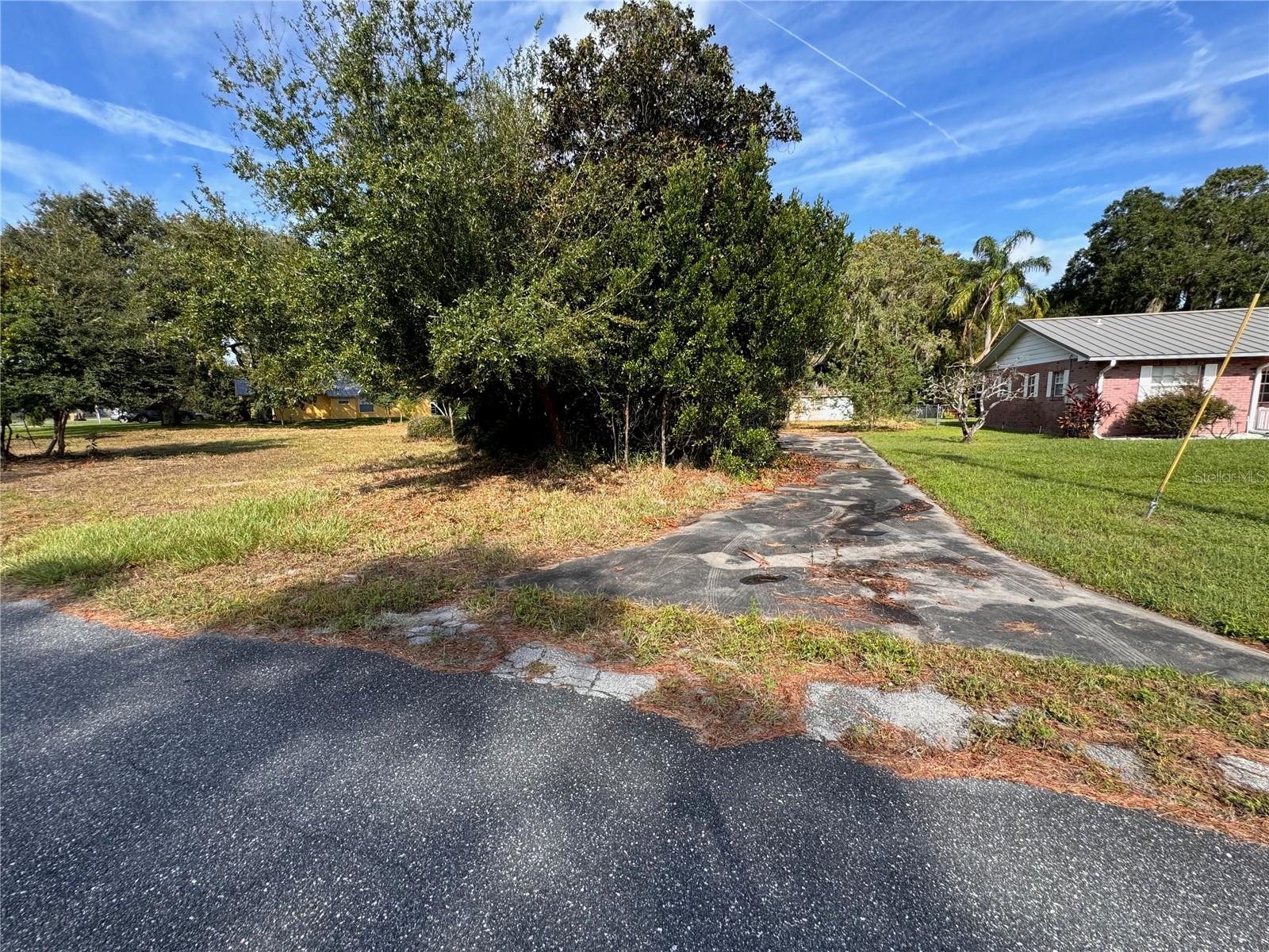
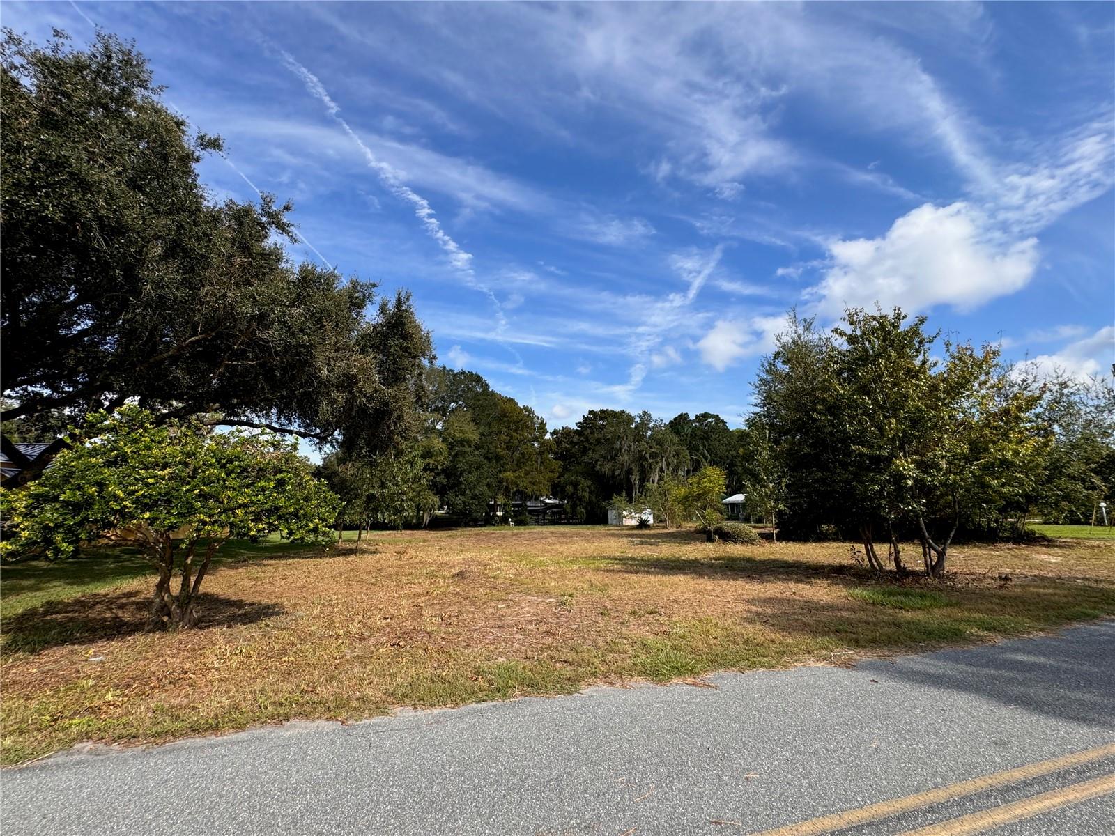
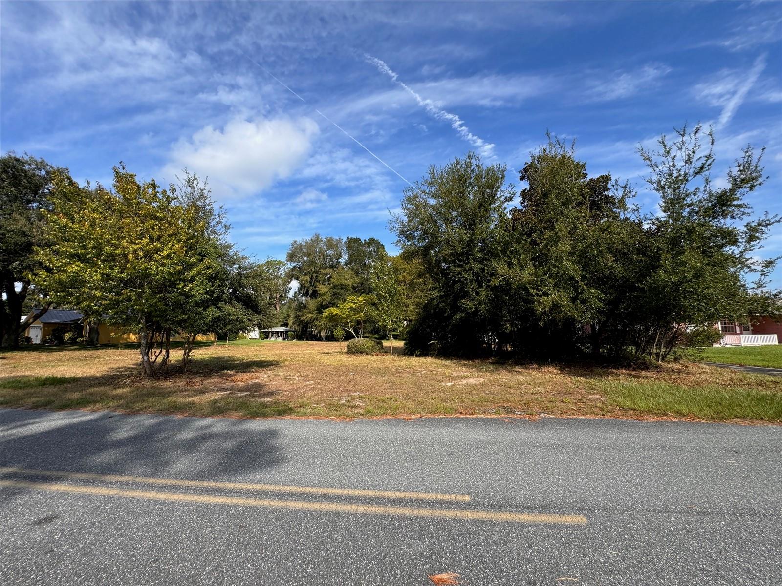
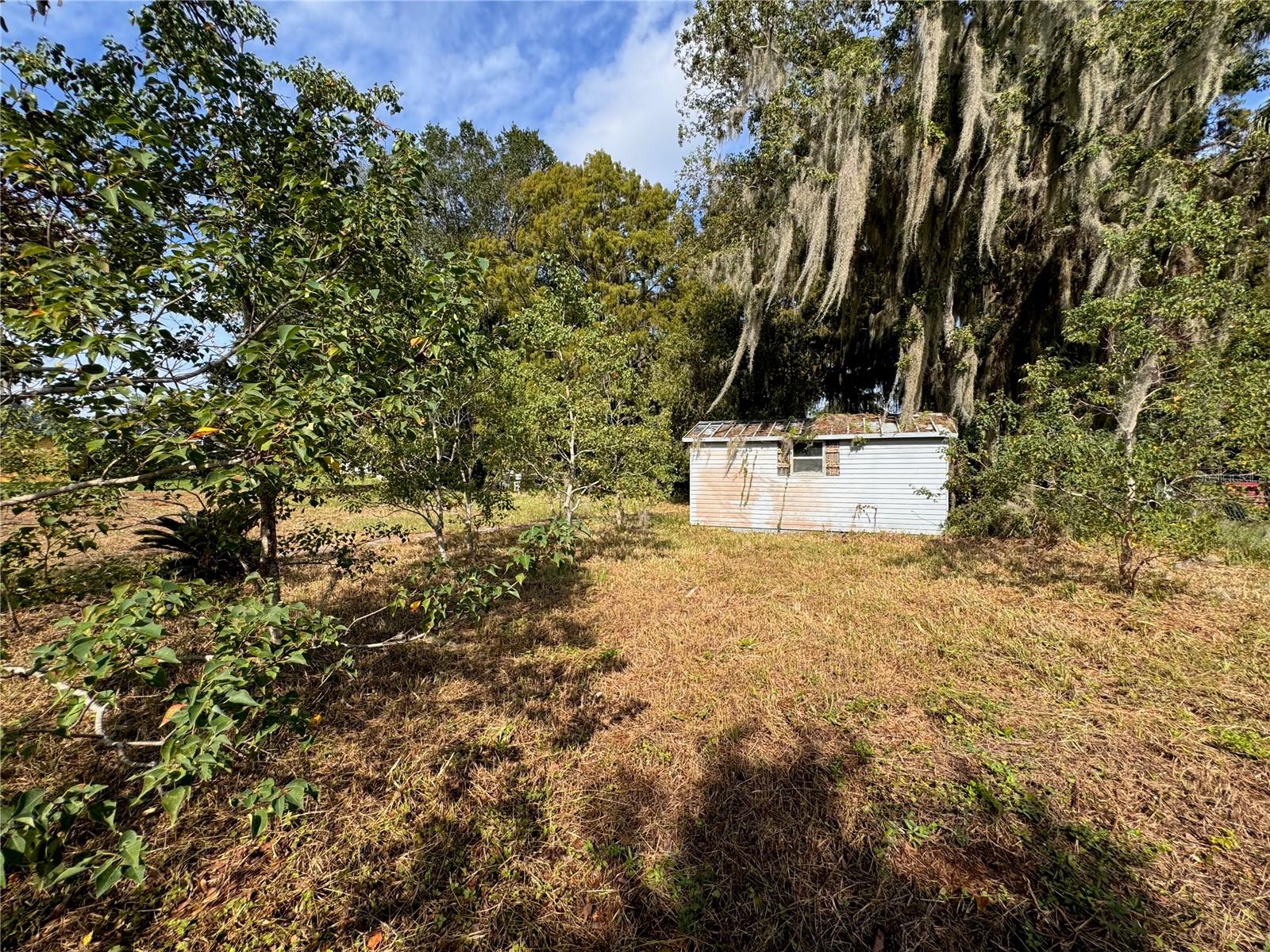
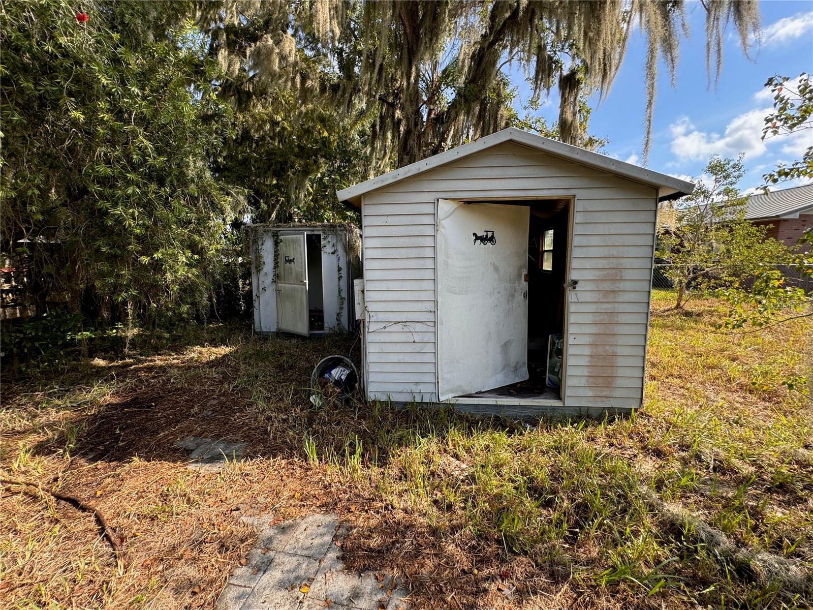
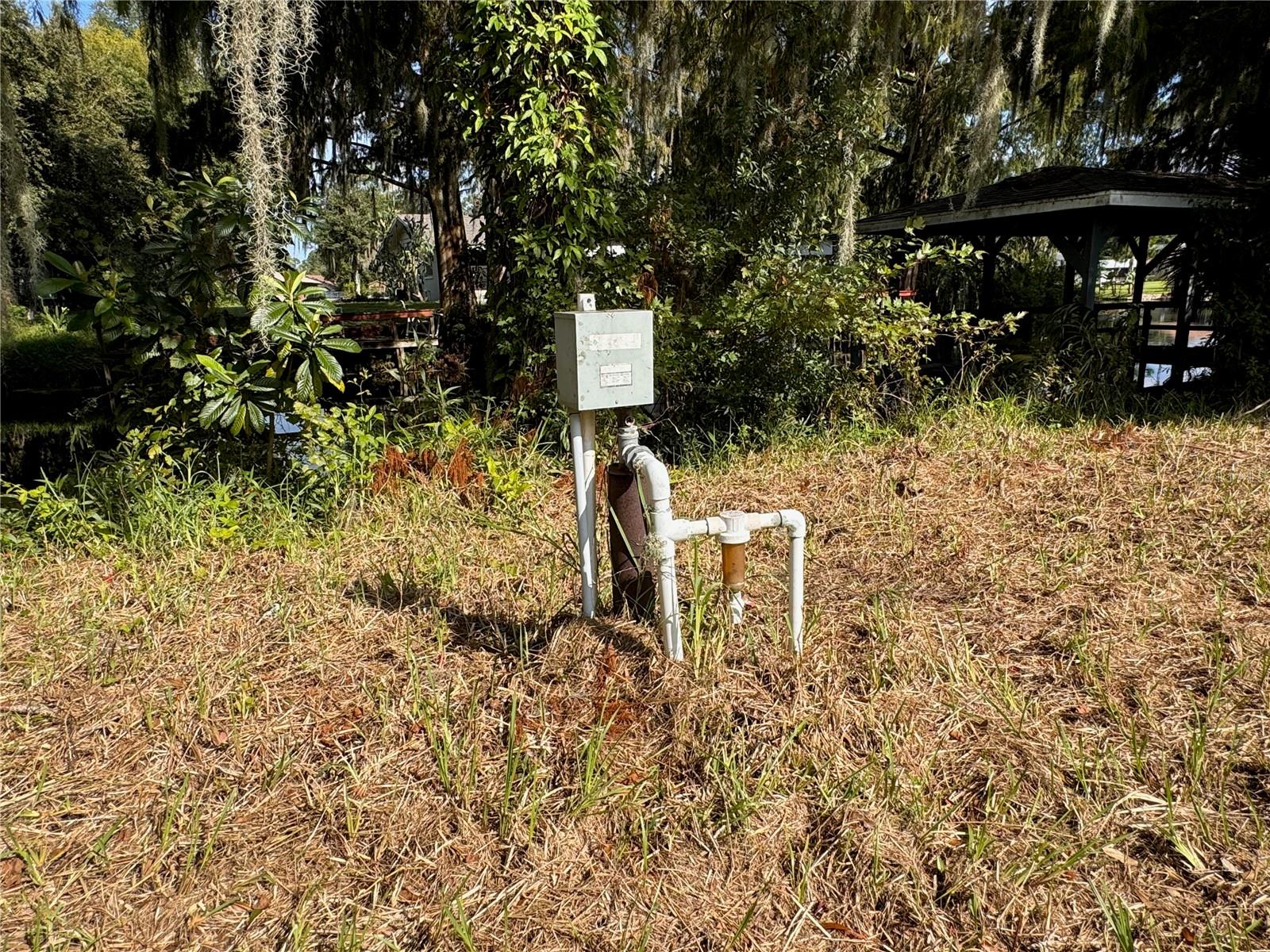
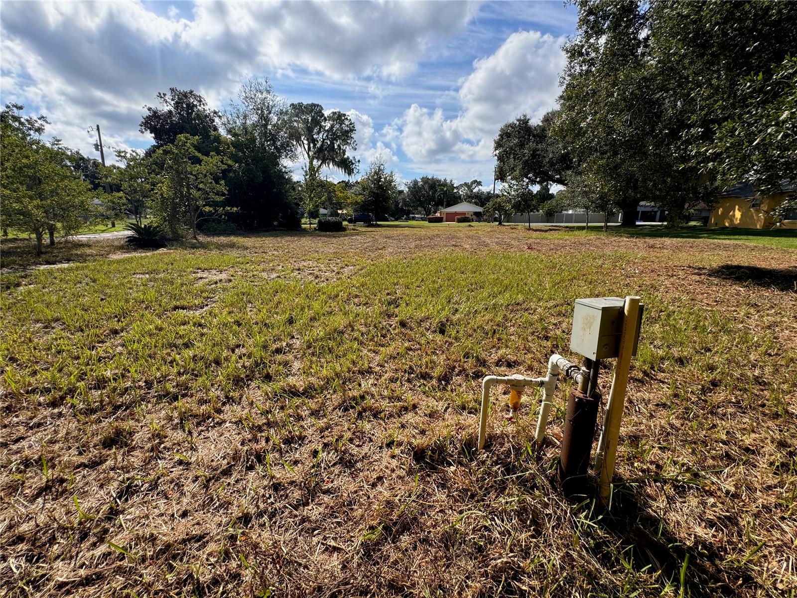
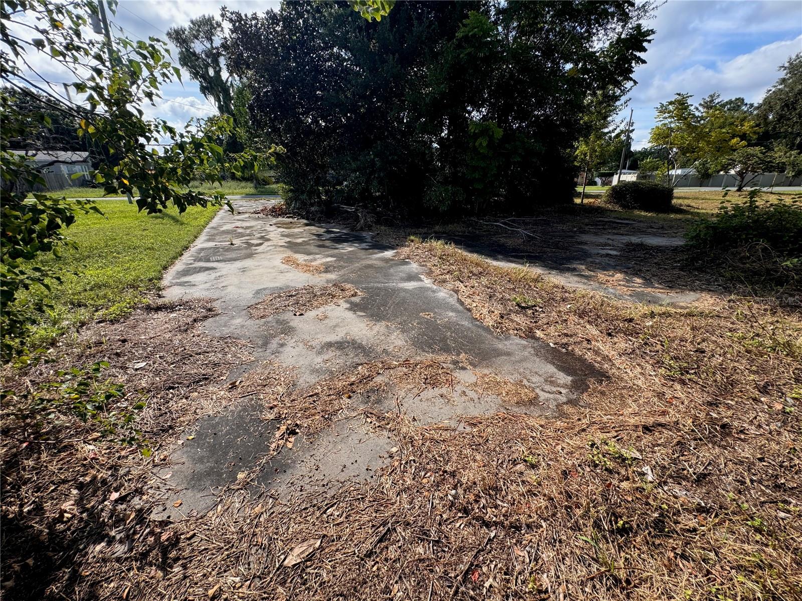
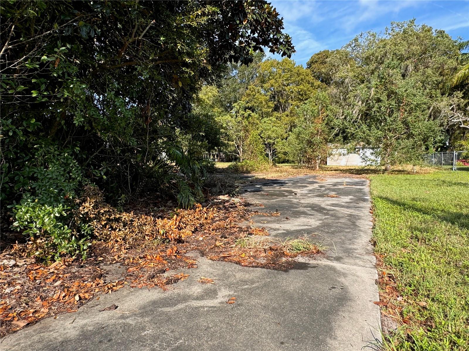
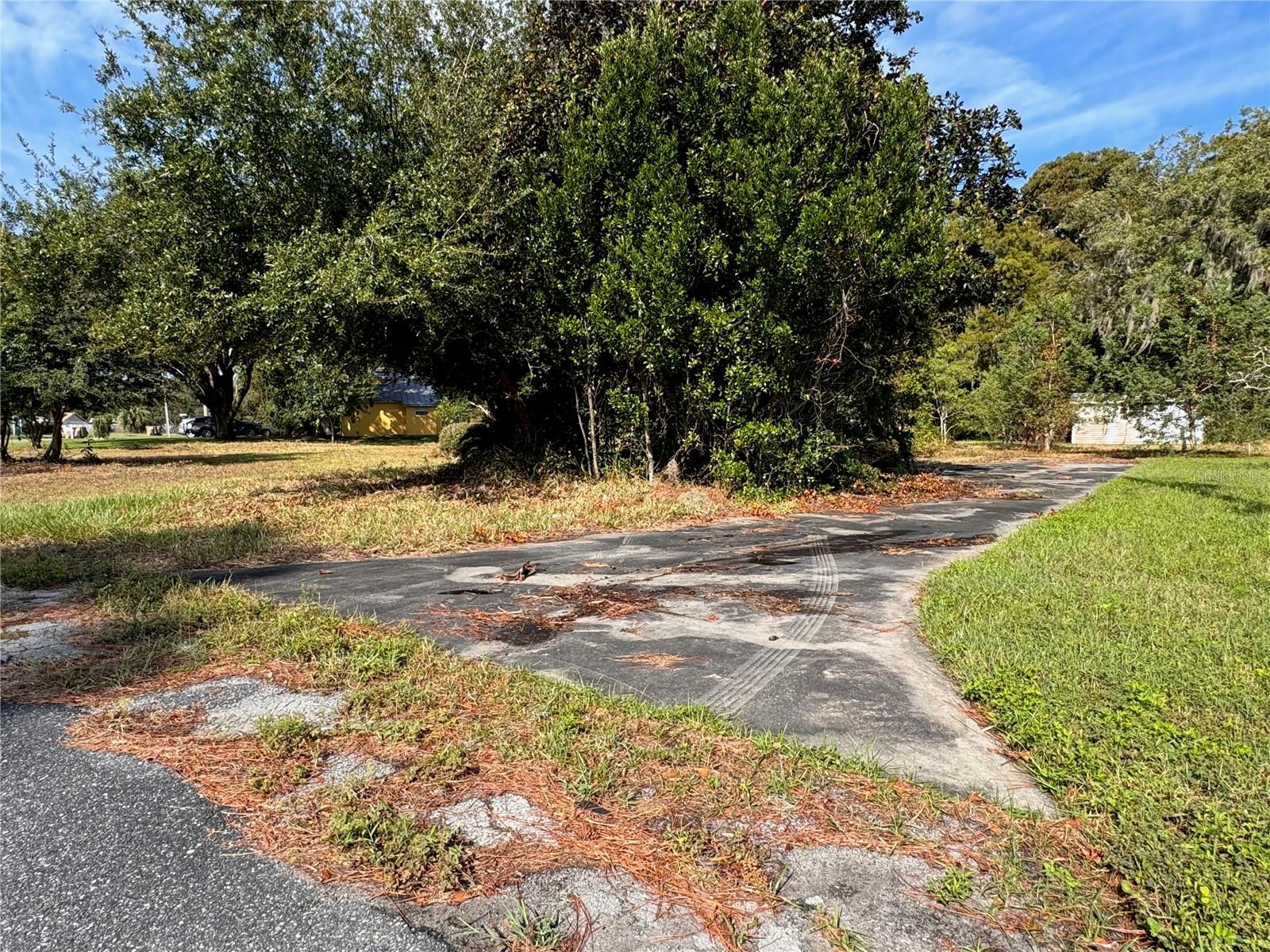
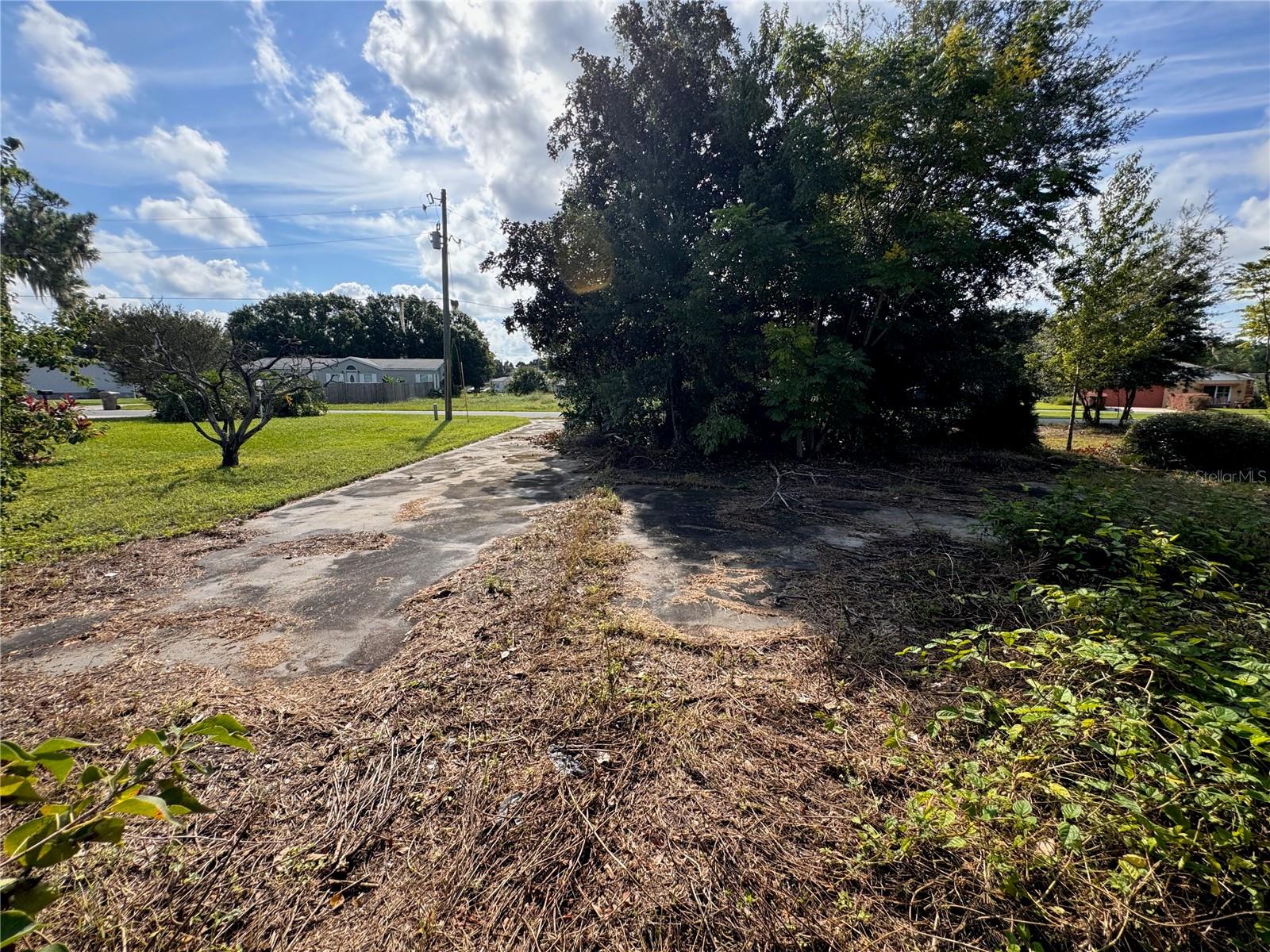
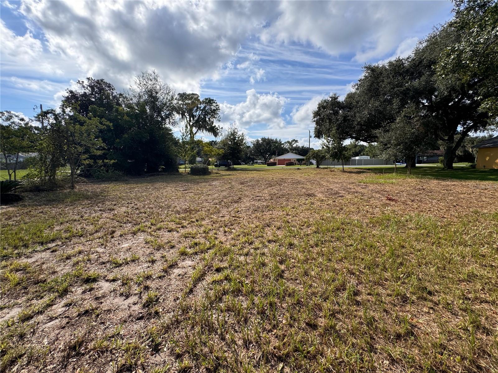
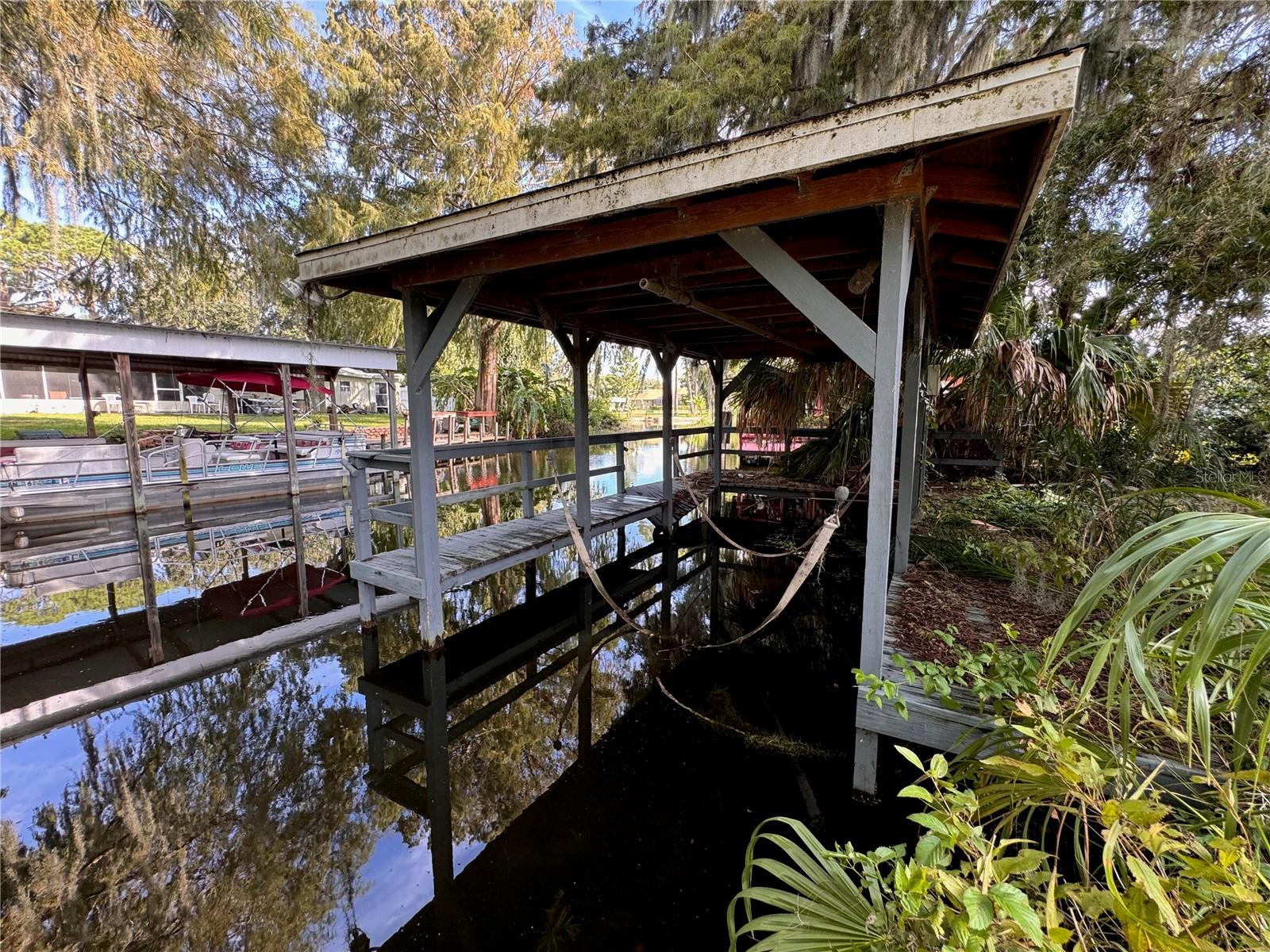
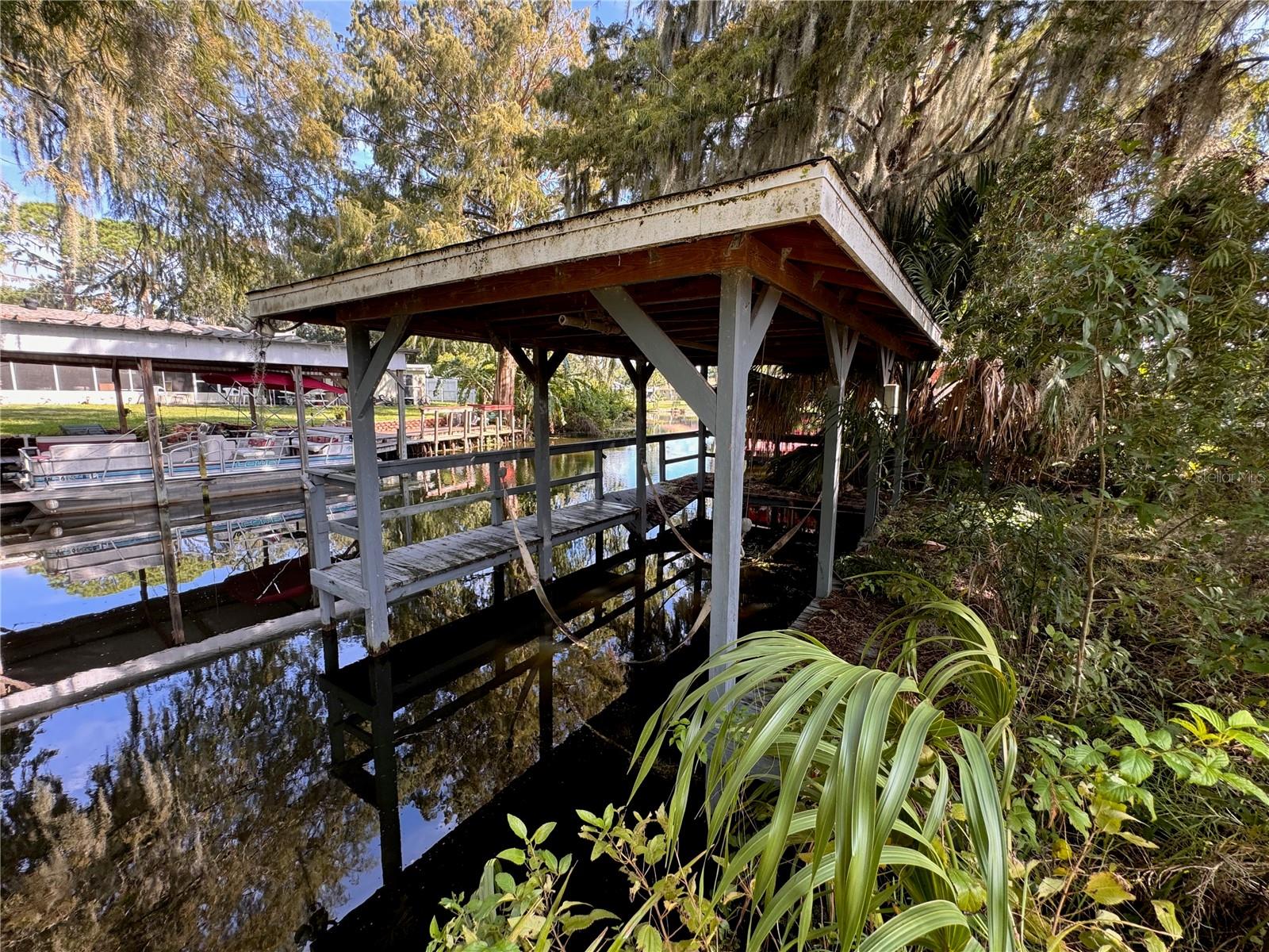
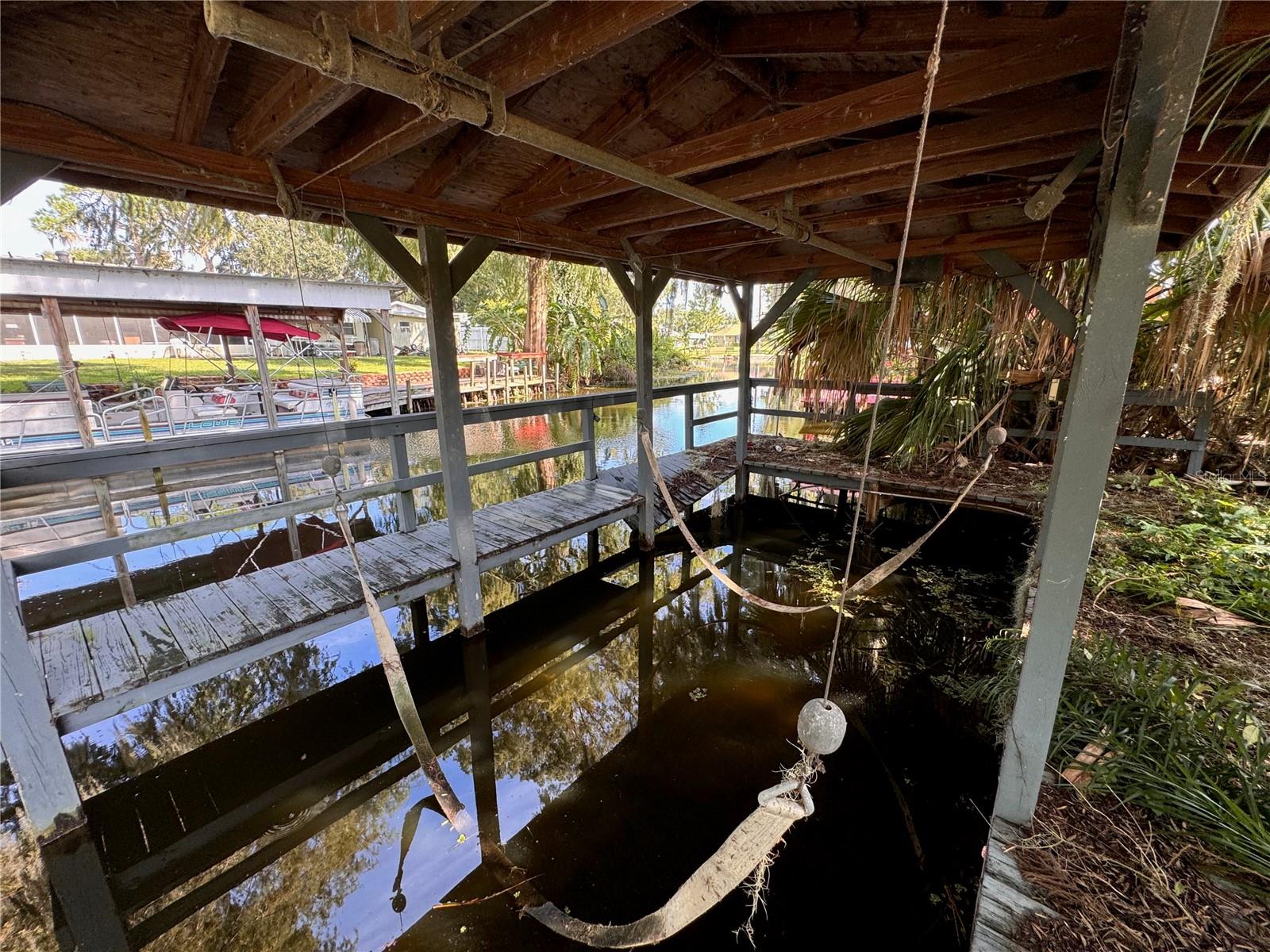
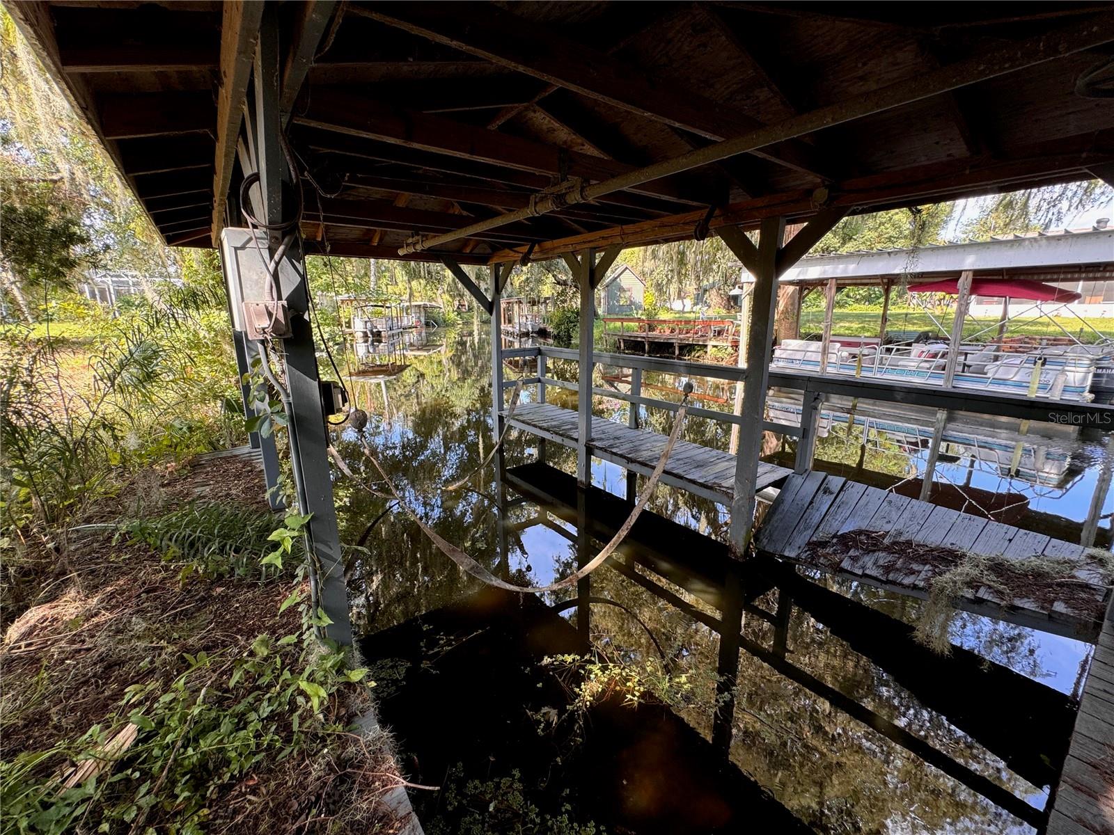
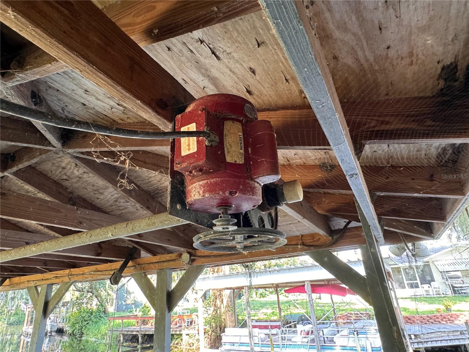
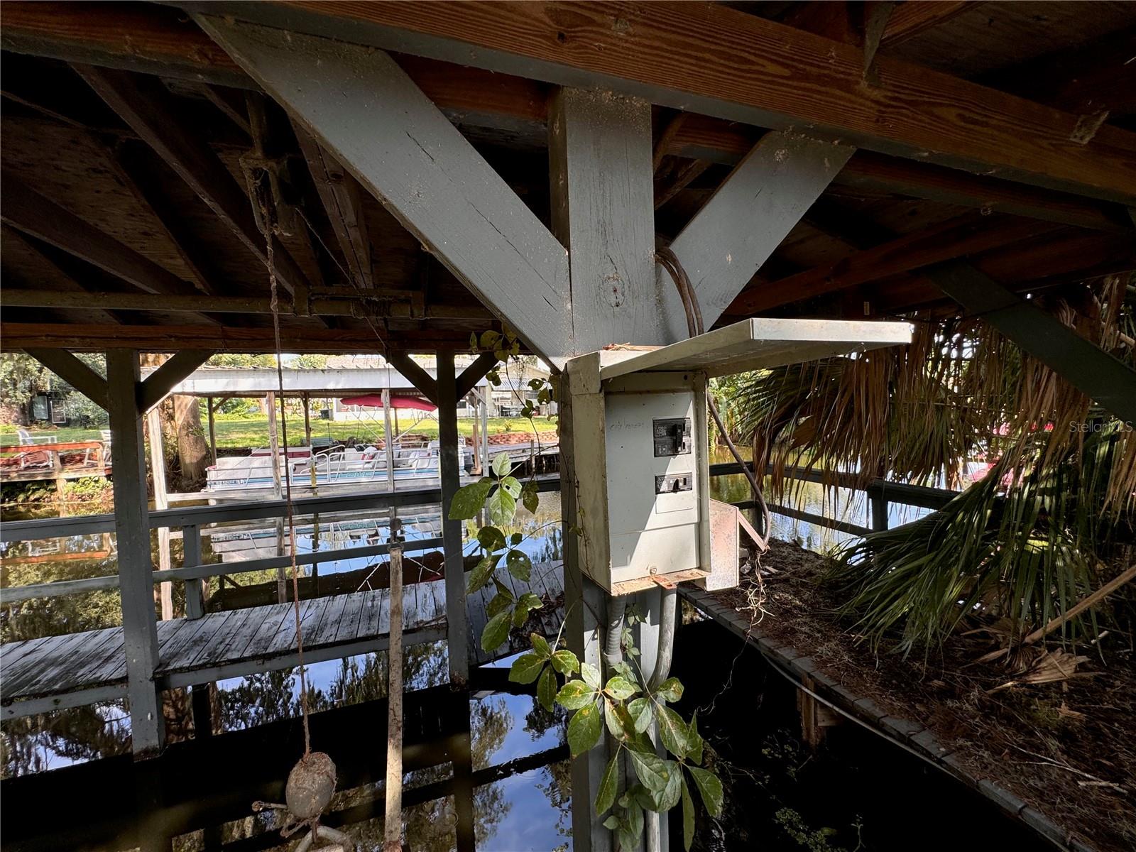
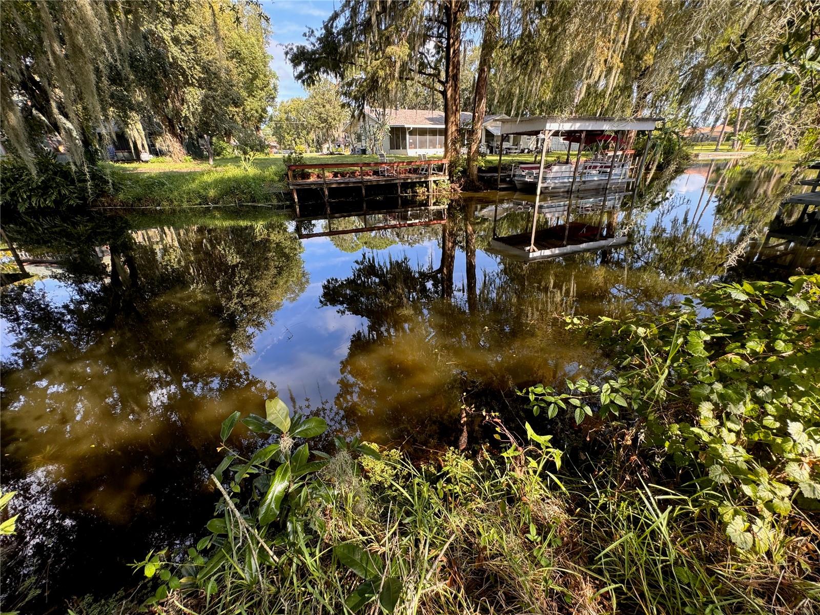
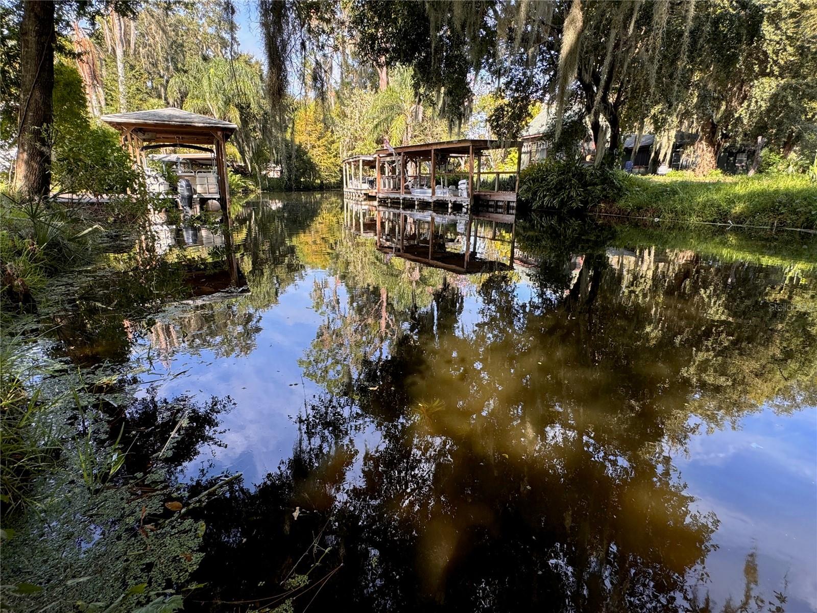
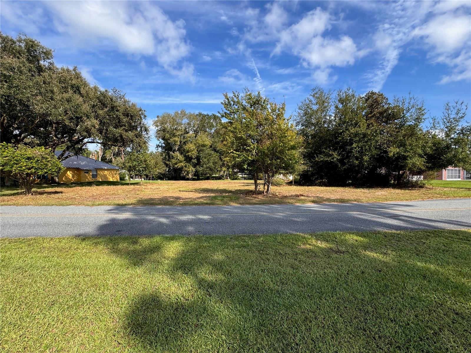
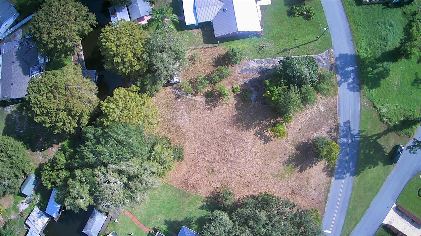
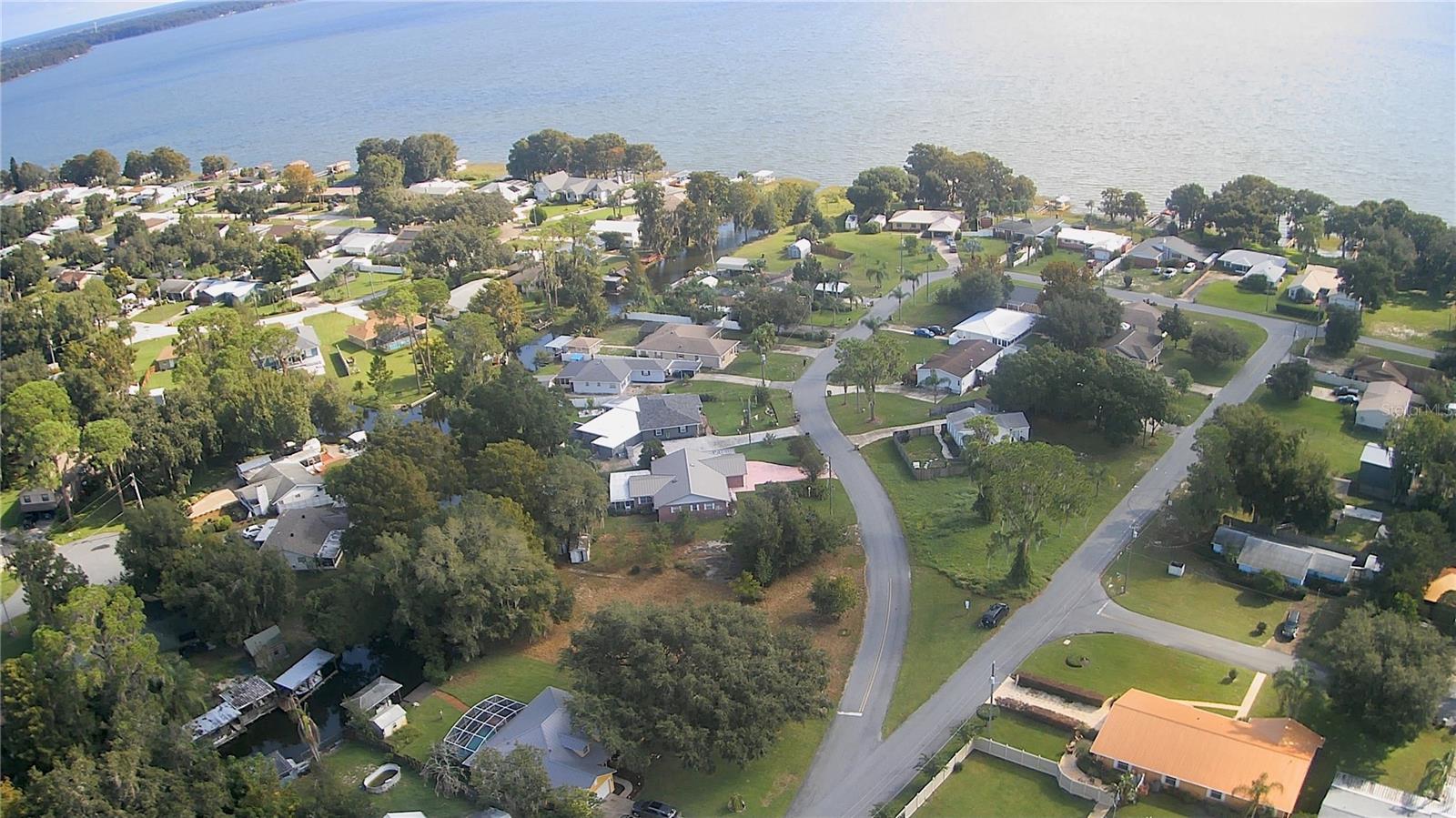
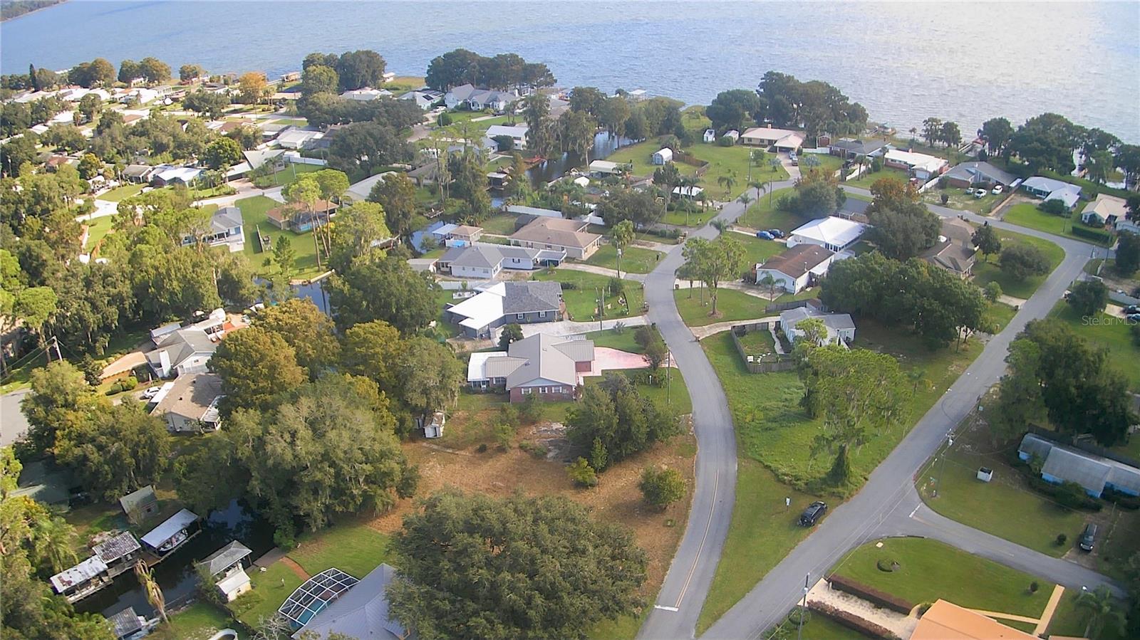
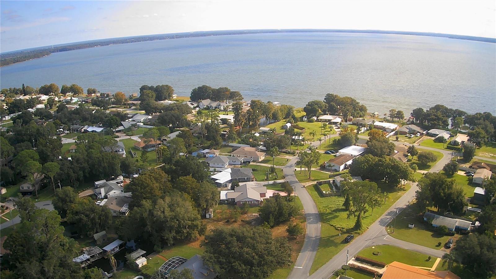
DescriptionWelcome to your waterfront oasis! This spacious .58 acre canal front lot offers the perfect setting to build your dream home. Located just off of scenic Lake Eustis, this property provides direct access to the stunning Harris Chain of Lakes, ideal for boating, waterfront dining by boat, fishing, and endless water activities. The lot features a concrete driveway from a previous home, along with a well and septic system already in place, although the condition of these features is unknown. Enjoy your own covered dock with a convenient boat lift, allowing for easy access to the water anytime. The dock needs repairs... but dock repairs are MUCH more affordable than new dock permits and construction. This lot is double sized compared to other lots in the neighborhood. Its size likely allows space for a detached garage, workshop, or RV and boat parking in addition to your new home. There's no HOA, so if the county allows it... you're good to go! Whether youre looking for a peaceful retreat or a launching point for adventures on the water, this property has it all!
Property Location and Similar Properties
Features
Waterfront Description
- Canal - Freshwater
Home Owners Association Fee
- 0.00
Carport Spaces
- 0.00
Close Date
- 0000-00-00
Country
- US
Covered Spaces
- 0.00
Current Use
- Residential
Garage Spaces
- 0.00
Insurance Expense
- 0.00
Legal Description
- WESTERN SHORES FROM NW COR OF SEC 18-19-26 RUN S 0-54-40 W 1236.40 FT N 82-44-50 E 261.53 FT TO THE BEGINNING OF A 100 FT RADIUS CURVE TO THE RIGHT THENCE RUN E'LY ALONG THE ARC OF SAID 100 FT RADIUS CURVE THRU A CENTRAL ANGLE OF 44-34-50 FOR A DIST OF 77.81 FT TO THE END OF SAID 100 FT RADIUS CURVE THENCE RUN N 37-19-40 E 25 FT TO THE BEGINNING OF A 400 FT RADIUS CURVE TO THE RIGHT THENCE E'LY ALONG THE ARC OF SAID 400 FT RADIUS CURVE THRU A CENTRAL ANGLE OF 52-0-0 FOR 363.028 FT THENCE N 14-40 -20 W ALONG A LINE RADIAL TO SAID 400 FT RADIUS CURVE 65.78 FT FOR POB RUN N 21-38-02 W 28.24 FT N 68-26-48 E 3.45 FT TO THE INTERSECTION OF SAID RADIAL LINE THENCE S 14-40-20 E ALONG SAID RADIAL LINE 28.44 FT TO POB BEING PART OF LOT 77 LOTS 78
Living Area
- 0.00
Lot Features
- Buildable
- Cleared
- In County
- Level
- Oversized Lot
- Paved
Area Major
- 34788 - Leesburg / Haines Creek
Net Operating Income
- 0.00
Open Parking Spaces
- 0.00
Other Expense
- 0.00
Other Structures
- Other
Parcel Number
- 07-19-26-0300-000-07700
Possession
- Close Of Escrow
Property Type
- Land
Road Frontage Type
- County Road
Sewer
- Septic Tank
Tax Year
- 2023
Township
- 19
Utilities
- BB/HS Internet Available
- Cable Available
- Electricity Available
- Fiber Optics
- Water Available
View
- Water
Views
- 45
Virtual Tour Url
- https://www.propertypanorama.com/instaview/stellar/G5087916
Water Source
- Well
Zoning Code
- R-6
